|
|
|
Does the Bible say Mt. Sinai is in Saudi Arabia ?
Did the boundaries of Arabia in Paul's day correspond
to the boundaries of modern
In Apostle Paul's
time, "Arabia" covered a wide area that "included
the Sinai Peninsula" as well as what we now call
A
glance at most Bible atlases will show this. Thus,
Paul's remark in Galatians 4:25 is quite consistent
with
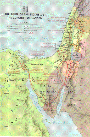
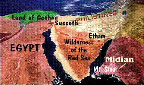
From
The Exodus
Discovered!
www.squidoo.com/theexodus www.arkdiscovery.com/red_sea_crossing.htm
|
|
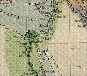
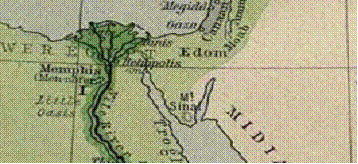
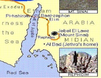
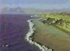
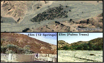
An
old map showing where Midian is located, in |
|
|
|
Out of
And they baked
unleavened cakes of the dough which they brought
forth out of Egypt, for it was not leavened;
because they were thrust out of Egypt, and
could not tarry, neither had they prepared for
themselves any victual.
Jethro lived
in Midian (Exodus 3:1).
Now Moses kept the flock of Jethro his father in law, the priest of Midian: and he led the flock to the backside of the desert, and came to the mountain of God, even to Horeb.
And
Jethro, Moses' father in law, came with his sons and
his wife unto Moses into the wilderness, where he encamped at
the mount of God:
And
Moses let his father in law depart; and he went his
way into his own land.
Jethro
"went his way into
his own land."
|
Midian is the
strip
of land, which makes up the east coast of the placing Midian in |
|
Hobab
When the Israelites were preparing to leave Sinai, Moses asked Hobab to stay with them. Moses said, "you know where we should camp in the wilderness, and you will be as eyes for us" (Numbers 10:31).
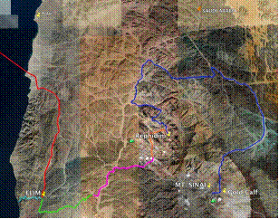
Mt. Sinai is outside the
Land of Midian
The Bible makes it very
plain that
Midian was in
From The Exodus Discovered! God
led
them by a pillar of a cloud by
day and a pillar of fire by
night.
They
traveled
day and night until they encamped in
Etham. They carried enough
water through this time, and enough unleaved
bread for seven days. They encamped at
Etham, the edge of the wilderness, before
they turned to go to the next camp which
would be "before Pihahiroth" (and between
Migdol and the sea).
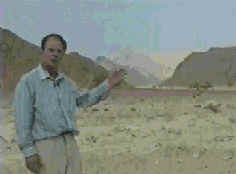
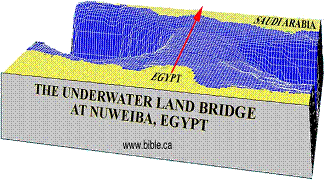
Underwater Land
Bride
|
|
|
|
|
|
|
The However,
on the side where the Israelites were trapped
was the canyon they had just come through.
Water rushing off the land soon after the flood
had carried with it a tremendous amount of sand
which had been deposited halfway out into the
Gulf. Miraculously, a similar canyon had
produced a tremendous deposit of sand
originating from the other side. The
location of both canyons was such that the sand
reached each other and formed
a land bridge of about 6/10ths of a mile wide
(900 m) by 8
miles (13 km) long
through the deep between the two sides. The slope both up and down on this land bridge was a gentle 6 degrees. |
|
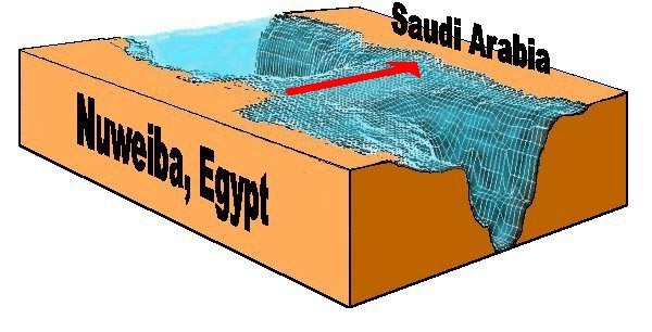
The
5,000 feet deep.
into this canyon
at a slope of 45
degrees.
“2640 feet deep”.
 |
 |
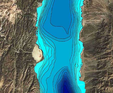
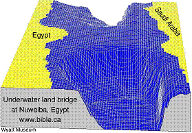
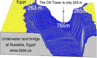
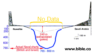
| The two graphics above are used by
those who favor a |
|
According
to the British admiralty nautical depth chart
12, the land bridge is not flat as
misrepresented above.
263 m = 862 feet
765m
= 2509 feet
or
.5 miles
This
means that as they started crossing, they were
at sea level (0m) then had to drop down
immediately to 263 m, then continue for 5 km. Next,
as they pass the 5 km mark, they drop down to a
valley that is 765 m deep. |
 |
 |
|
This
means that if we placed the CN tower at the
deepest spot of 765m, the top of the CN tower
would about even with the first 263 m shelf.
|
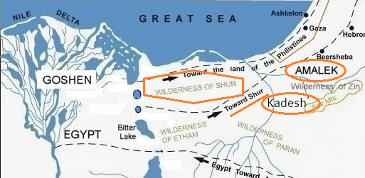
Wilderness of Shur
|
They were entangled in the land
because of the narrow Wadi Watir that leads into
Nuweiba ( |
|
|
|
|
Where is the Wilderness of Shur?
 |
|
(Gen 20:1 (1 Sam 27:8 |
Marah waters have not been found. http://www.squidoo.com/theexodus
|
This rout is about 35 to 40 miles from the gulf of Aqaba. |
 |

|
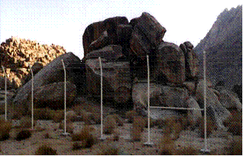
Moses
Altar
|
 |
|
|
An altar of
earth thou shalt make unto me, and
shalt sacrifice thereon thy burnt offerings, and thy
peace offerings, thy sheep, and thine oxen: in all
places where I record my name I will come unto thee,
and I will bless thee.
And if thou wilt make me an altar of stone,
thou shalt not build it of hewn stone: for if thou
lift up thy tool upon it, thou hast polluted it.
Neither shalt thou go up by steps unto mine altar, that thy nakedness be not discovered thereon.
![]()
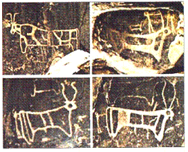
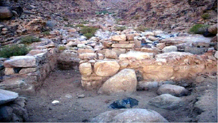
Golden Calf Altar
|
From The Exodus Discovered! Golden Calf Altar Before |
|
|
|
|
A pile of rocks, 30’ by 30’ by 20’ high, and flat on the top.
(Exo 32:4
Aaron built
that altar?
He most of
been one strong, real strong man!
Moses,
burnt the calf in fire and ground it to powder
(Exo 34:13
If
God
commanded them to destroy the heathen altars, wont
Moses destroy the altar of the golden calf
and the images?
| YES He Would |